How to send real-world terrains
to Unreal Engine

Honolulu heightmap

This document explains how to create a landscape in Unreal Engine from real-world data using Instant Terra’s World browser.

Prerequisites

Instant Terra
Instant Terra 2.3.3 or Instant Terra Pro 2.3.3, or any newer version, must be installed on the computer.

Unreal Engine plugin
Download the plugin from Unreal Engine marketplace.

Initialization in Unreal Engine

The first step is to create a landscape in Unreal Engine. Its size is unimportant for the moment. Its final size will be determined by the size of the terrain you will download.

Select the terrain actor (named Landscape by default) from the World Outliner window and right-click to open its contextual menu.

The contextual menu shows a Create Instant Terra project entry.

menu

Click on Create Instant Terra project.
A new actor named InstantTerraProject is displayed in the window.

instantterraproject actor

Building your project in Instant Terra

Prepare the project

Instant Terra is launched automatically and opens a default project.

instant terra default project

Delete all groups except Terrain size and Send to Unreal.

prepare project

Download the real data

Open the World browser by clicking on its tab.

world browser in instant terra

Select the region you want you download, then download it.

download real data
real data heightmap

Compatibility with Unreal Engine

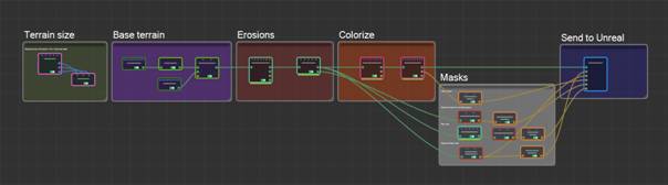
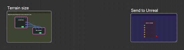
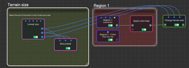
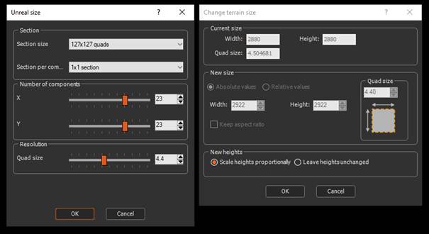
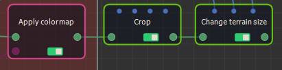
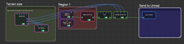
Once the terrain is downloaded, you need to resize it to obtain a size that is compatible with Unreal Engine.

To do so, add a Change terrain size node and link the three connectors of the Unreal size node (named width, height, and quad size) to the three connectors of the Change terrain size node (named new width, new height, and new quad size).

change size

Modify the properties of the Unreal size node to obtain a size (in number of vertices) that is as close as possible to the size of the downloaded region.

You can open both windows at the same time by double clicking on the nodes.

unreal size

To keep the same terrain size in meters, adjust the quad size (the resolution of the terrain in meters) so that the width in number of vertices multiplied by the quad size remains the same.

In this example: 2880 x 4.5 <–> 2922 x 4.4

Note: If the downloaded terrain is not square, use a Crop node to make it square.

crop to get a square terrain

Connect the Change terrain size node to the Use in Unreal node, remove the layers that are not needed, and click on the Send to Unreal button to send the terrain to Unreal Engine.

send to unreal

Note: If you downloaded the satellite image as well, it cannot be send to Unreal this way. You have to import it into Unreal, create a material from it, and apply the material to the terrain.

-->