Instant Terra 2.5
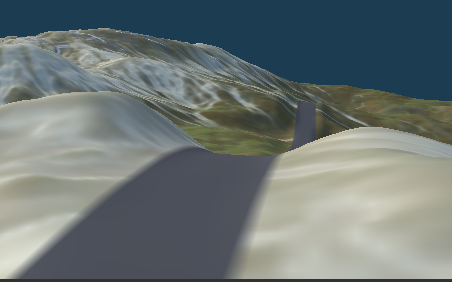
Define the locations of your roads and adapt the terrain accordingly.
1
Read More
Instant Terra 2.4.5 available.
Interactive tutorials – Mask from color
Combine the best out of Instant Terra & Houdini’s power for your terrains
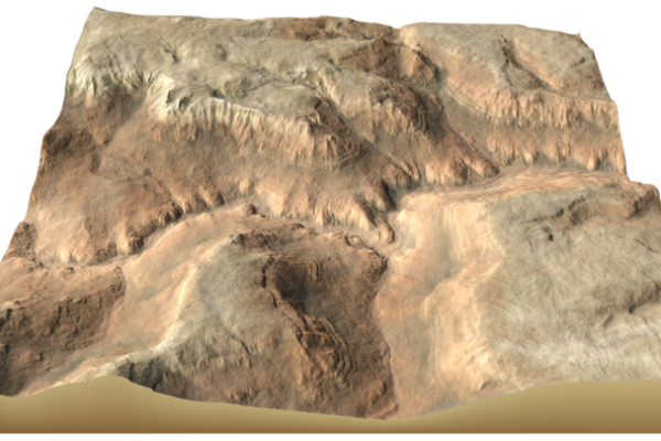
New erosion nodes for a wider range of results. Thermal erosion multi-scale erosion, and mountain aging effect.
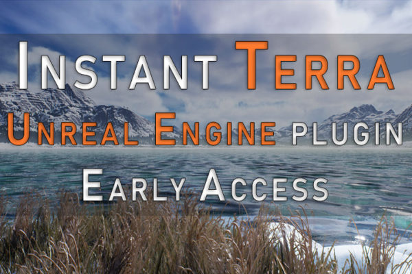
Creating terrains in Unreal Engine has never been so easy! Compatible with UE 4.26, UE 4.27 Preview, and UE 5 Early Access Select your version and download the plugin Initialize your terrain in Unreal Engine.Edit your terrain in Instant Terra and define the different layers you need.In one click, terrain and layers are ready in Unreal Engine.It’s that simple!

Instant Terra 2.2 now available!
Download satellite images with your heighmaps for immediate stunning results.
Instant Terra 2.1 now available!
Additional data sources for much more detailed regions, new Blur and Warp nodes, improvements on erosions, and much more!